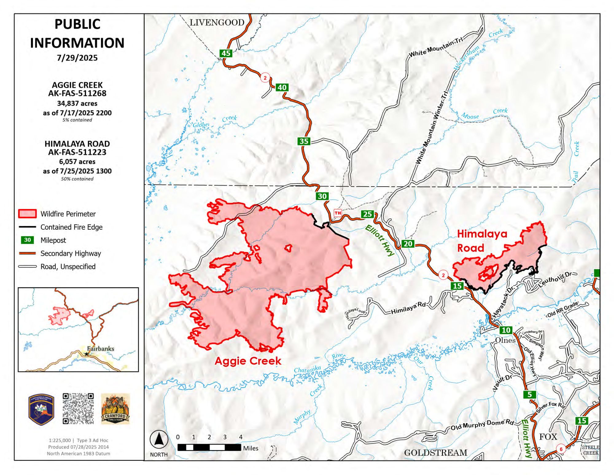
The Alaska State Parks Whitefish Campground is now reopened to the public for recreation due to moderated fire weather and the rightsizing and consolidation of incident resources. Containment increased on the Himalaya Road Fire (#223) to 50% as the fire perimeter held during the hot and dry temperatures seen throughout the weekend. Additionally, the Temporary Flight Restriction (TFR) has been altered. The affected airspace has decreased and has now split into two separate TFRs to cover the Himalaya Road Fire and the Aggie Creek Fire separately.
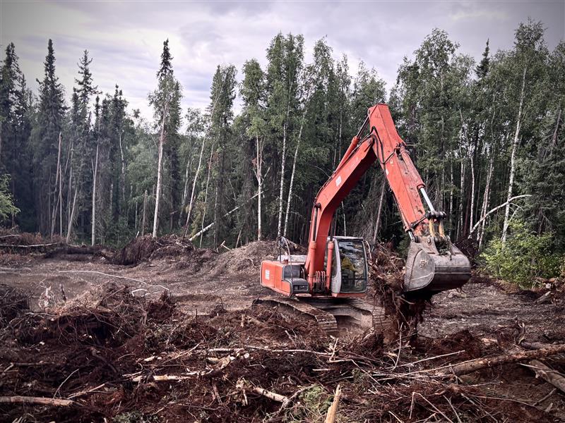
Operations: Dampened by the rain yesterday, fire activity was very minimal across both the Himalaya Road and Aggie Creek Fire (#243). Dozer lines received a lot of moisture from the rain showers, which prevented crews from moving equipment around through the mud. Heavy equipment operations will continue on the steeper terrain when the dozer lines dry more in the upcoming days to continue with suppression repair. Assessment of Himalaya Road was conducted yesterday to determine the rehabilitation needed torepair the road conditions. Unmanned Aerial Systems (UAS) will be utilized again on Thursday to seek out heat sources that may be continuing to smolder in both fire footprints. Crews will patrol and monitor any areas of concern and continue to secure the fire line.
Weather: A high of 60° F and a low of 53° F, with a light southwest wind, is expected. Light rain is forecast throughout the day and night.
Smoke: For smoke outlook updates, go to https://outlooks.airfire.org/outlook/e16e3fa2.
Closures: Check https://511.alaska.gov/map for road conditions. Olnes Pond Campground remains closed to the public for use by the fire crews.
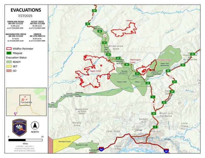
Evacuations: Level 1 “READY,” evacuations are still in effect. Level 1indicates that a fire is present in the area and to prepare for potential evacuation. Visit https://bit.ly/FNSBevac for current evacuation levels.
Safety: A Temporary Flight Restriction is still in place; check https://tfr.faa.gov/ for changes. Do not fly drones over the fire area. Unauthorized drone use poses serious risks to firefighter and public safety – If you fly, we can’t.
Categories: Active Wildland Fire, AK Fire Info, Alaska DNR - Division of Forestry (DOF)
