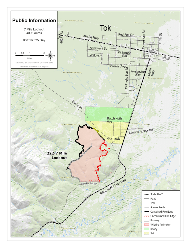
Size: 4,094 acres
Location: 7 miles southwest of Tok
Start Date: June 19, 2025
Cause: Lightning
Containment: 55%
Total Personnel: 125
Evacuation Notices:
READY (Level 1): Residents north of Butch Kuth Avenue and on Jack Wade Road
SET (Level 2): Residents on Osprey Road, Moose Nugget Road, and Goshawk Road
Operations:
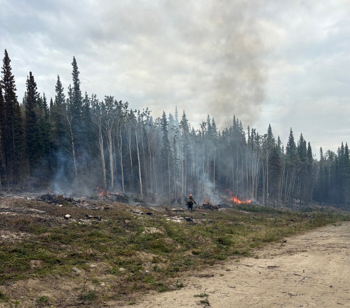
A test fire was conducted Thursday on unburned interior fuels along the eastern edge of the 7 Mile Lookout Fire. However, high humidity limited fire behavior and prevented a clean, complete burnout. Firefighters will continue to monitor conditions and test fuel moisture in preparation for a full burnout operation when conditions allow.
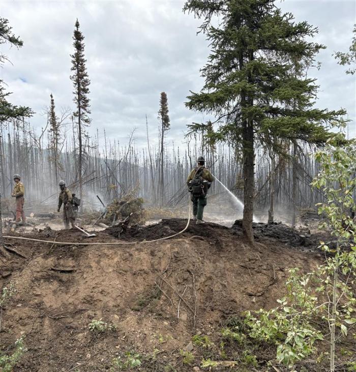
The Tanana Chiefs T2IA, Pioneer Peak IHC, Gannett Glacier T2IA, and North Star Fire Crews are cutting and piling fire-weakened trees to reduce hazards and prevent reignition from smoldering duff layers. Along the southern perimeter near 7 Mile Lookout Road, crews are gridding for hot spots, conducting mop-up, and using folding tanks and hose lines to saturate deep-burning fuels. Piled debris will be burned in place, and drones are assisting in detecting lingering heat to reinforce containment lines on the southern and western flanks.
Although cooler and wetter conditions are forecasted as fall approaches, fire season is not yet over. A drying trend may still return, and firefighters remain focused on completing suppression objectives while the operational window remains open.
Weather:
Fire activity is expected to remain minimal. Cloudy skies and scattered showers are possible through the weekend, with wetting rain, up to one inch, forecasted Friday night into Saturday. Temperatures will stay in the upper 60s with light to occasionally gusty winds through Saturday.
Road Advisory:
Drivers are encouraged to check current road conditions at 511.alaska.gov and use caution when traveling near the fire area.
Aircraft and Drone Restrictions:
A Temporary Flight Restriction (TFR) – FDC 5/4836 – remains in effect over the fire area. The public is reminded not to fly drones or other aircraft near the fire.
If you fly, we can’t.
Click Here to view/ download a PDF version of this update.
Categories: Active Wildland Fire, AK Fire Info, Alaska DNR - Division of Forestry (DOF)
