A wildfire southeast of Tok grew by about 4,000 acres on Tuesday, prompting fire managers with the Alaska Division of Forestry to change tactics from full suppression to point protection.
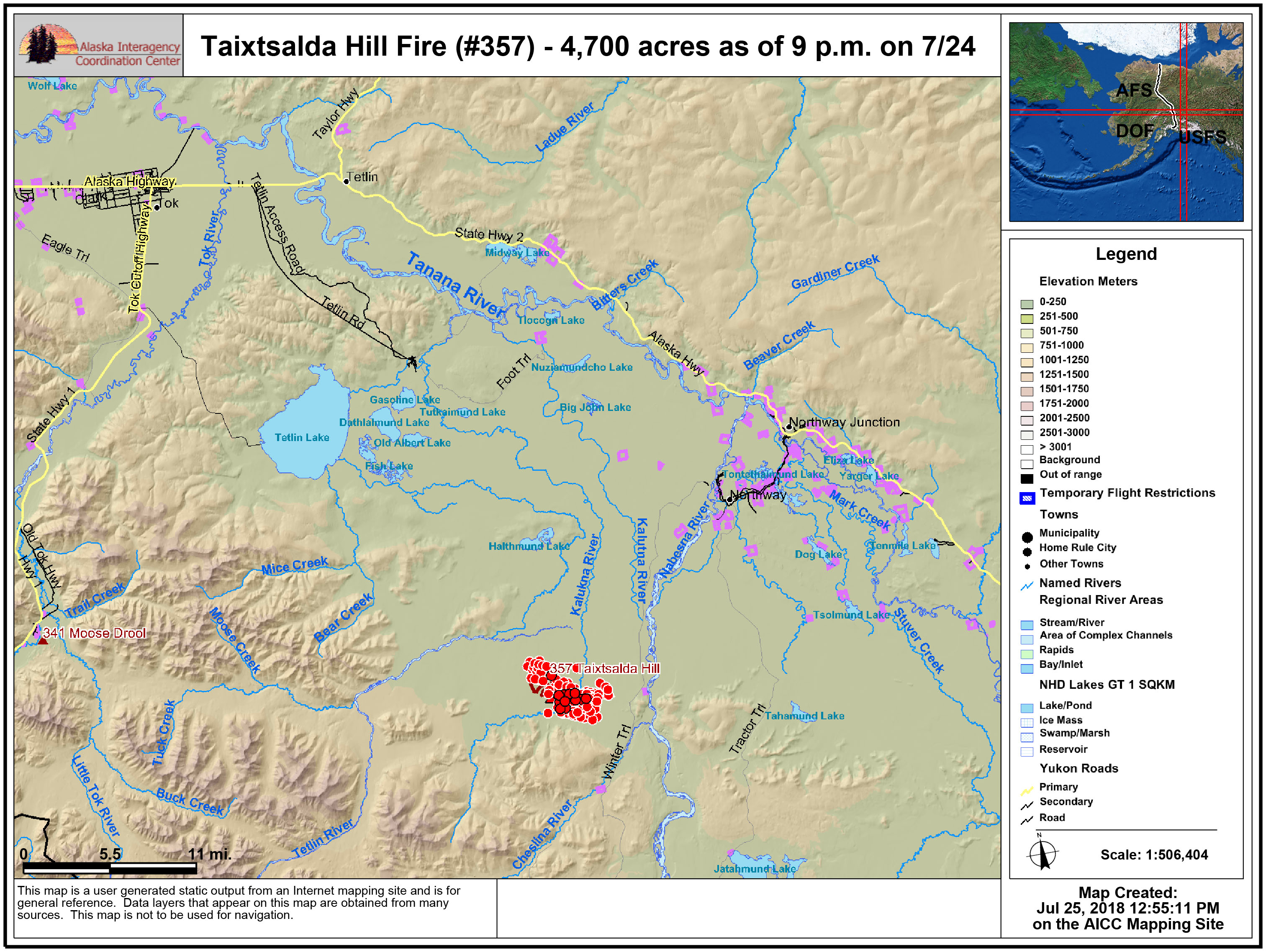
A map showing the location of the Taixtsalda Hill Fire (#357). The red dots signify heat detected by satellite.
The Taixtsalda Hill Fire (#357), which started on Monday, is now estimated at approximately 4,700 acres. It is burning about 38 miles southeast of Tok and 14 miles southwest of the village of Northway. The cause of the fire is unknown and is under investigation.
Fire managers initially were employing a full suppression strategy in hopes of containing the fire but switched gears on Tuesday afternoon when fire behavior intensified and direct suppression tactics were deemed unsafe for firefighters. There are 65 personnel working on the fire, including three Type 2 hand crews.
Fire managers are assessing what values are threatened by the fire, such as Native allotments and cabins, and are developing a plan to protect them. The closest Native allotment is about 3 miles east of the fire and there is a U.S. Fish and Wildlife Service cabin approximately 6 miles southeast of the fire.
Crews are being shuttled into the nearest allotment by helicopter to begin cutting saw line and laying hose and pumps around the allotment to prep it for protection in the event the fire reaches it.
The fire grew significantly Tuesday with another day of hot, dry, windy weather in the eastern Interior that saw temperatures climb into the mid 80s. More hot, dry weather is forecast through the end of the week, which will likely result in continued fire growth. Most of the new growth on Tuesday was on the southeastern edge of the fire.
The smoke column from the fire is visible from the villages of Northway and Tetlin, as well as the Alaska Highway, but smoke is not impacting the highway. The fire is roughly 20 miles west of the highway.
Categories: Active Wildland Fire, AK Fire Info
