Firefighters continue to set up protection measures around Native allotments and cabins threatened by the Taixtsalda Hill Fire (#357) in hopes of conducting burnout operations to widen and reinforce containment lines around them.

Smoke rises from the Taixtsalda Hill Fire (#357) on Friday, July 27. Peter Talus/Alaska Division of Forestry.
The latest size estimate for the Taixtsalda Hill Fire is 14,428 acres, a decrease of more than 500 acres from Saturday, according to the Alaska Division of Forestry. The reduced acreage is due to better mapping.
The fire, which started Monday, is burning on Tetlin Native Corporation lands approximately 38 miles southeast of Tok and 14 miles southwest of Northway.
Cooler, cloudier conditions produced only moderate fire behavior on Saturday, the first day since the fire started that it did not show a significant acreage gain. However, hotter, drier conditions are expected over the next three days as a high pressure system rebuilds over the eastern Interior and pushes temperatures back into the 80s. The hotter, drier weather is likely to increase fire behavior and result in further growth.
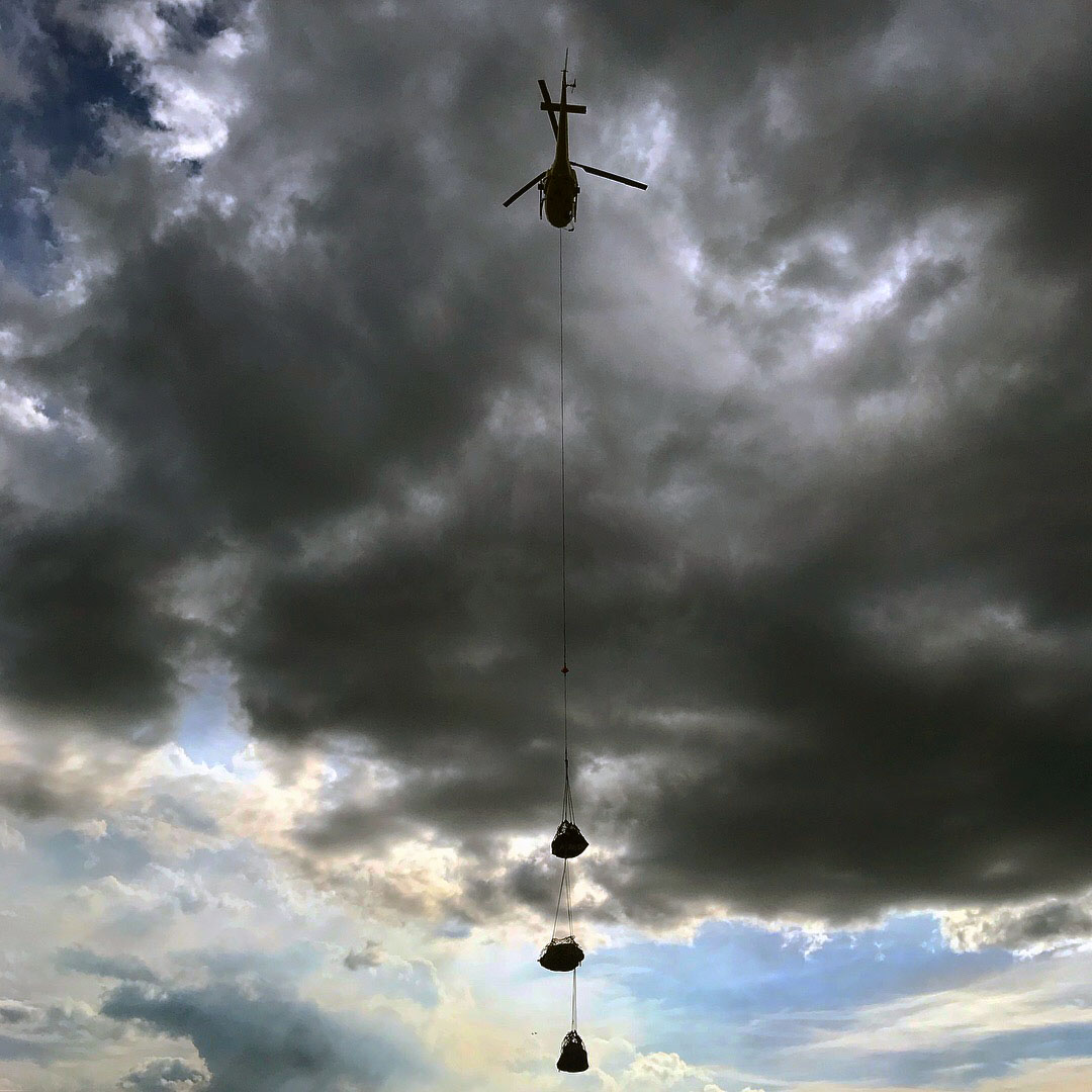
A helicopter hauling a sling load of supplies for firefighters on the Taixtsalda Hill Fire takes off from the Northway Airport on Saturday, July 28, 2018. A multiple sling load like this is called a “daisy chain.” Rachel Calderwood/Alaska Division of Forestry
There are 138 personnel working on the fire, which is being managed by a Type 3 incident management team based in Northway. Firefighters are focusing their efforts on point protection rather than direct suppression because of safety concerns and the large size of the fire.
Firefighters on Saturday completed cutting a saw line and laying a hose line around an allotment approximately 2 miles south of the fire and also worked on improving saw and hose line around an allotment approximately 2 ½ miles to the east along the Nabesna River. Hose and pumps have been tested and firefighters are now waiting for favorable conditions to burn. Firefighters also cleared brush around a U.S. Fish and Wildlife Service repeater site about 5 miles south of the fire.
Firefighters continued to assess allotments and cabins at Jatahmund Lake, approximately 10 miles southeast of the fire, should the fire cross the Nabesna River and encroach the lake.
Helicopters are being used to shuttle firefighters and supplies around the remote fire.
As they have been for the past three days, fire managers continue to assess and inventory allotments and other values that may be threatened by the fire should it continue growing toward the villages of Northway, 14 miles to the northeast, and Tetlin, 15 miles to the northwest. Management action points have been identified in multiple directions to dictate a plan of action should the fire reach those points.
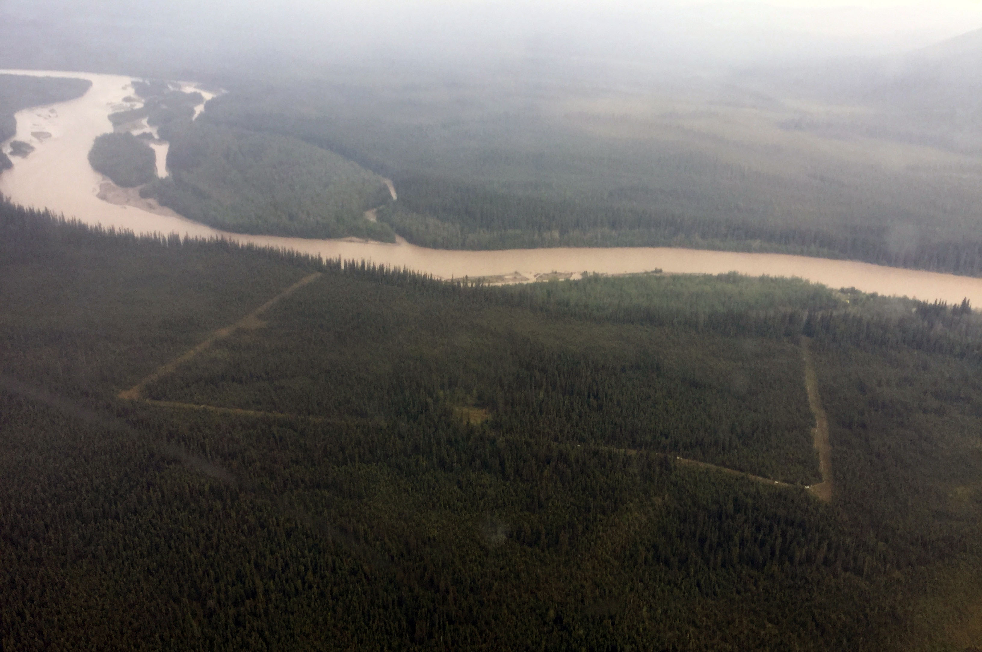
A saw line that has been cut around a Native allotment along the Nabesna River is visible from this aerial photo taken on the Taixtsalda Hill Fire near Tok. Matt James/Alaska Division of Forestry
Travelers on the Alaska Highway can see smoke from the fire but the smoke is not impacting the highway. The fire remains approximately 20 miles west of the highway. More smoke may be visible from the highway, as well as the villages of Northway and Tetlin, if a burn operation is conducted.
About a half dozen local residents attended a community meeting held in Tok on Saturday during which fire managers laid out the operational plan for the fire and answered questions.
A Temporary Flight Restriction (TFR) remains in place over the fire to provide a safe environment for multiple firefighting aircraft that are flying in the area. To check on the specific coordinates of the TFR, pilots can go to http://tfr.faa.gov/save_pages/detail_8_5595.html.
For more information about the Taixtsalda Hill Fire, call the fire information line in Tok at (907) 707-9866.
Categories: Active Wildland Fire, AK Fire Info
