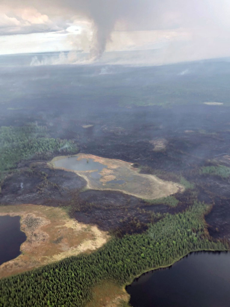
A photo of the Swan Lake Fire taken during a helicopter reconnaissance flight on Wednesday evening, June 12, 2019. The fire in the Kenai National Wildlife Refuge is now estimated at 8,400 acres. Photo by Kale Casey/Alaska Division of Forestry
Yesterday, west winds pushed the lightning-caused Swan Lake Fire further east into the Dave Spencer Unit of the Kenai Wilderness, resulting in an increase in acreage of about 1,400 acres. The fire is now mapped at an estimated 8,400 total acres, according to the Alaska Division of Forestry.
Crews observed shifting winds throughout the day and reported periods of increased fire behavior as they worked on the southwest section of the fire, preparing to defend the Enstar gas pipeline and improve indirect fireline along the East Fork of the Moose River.
Fire crews are taking advantage of suppression work completed during the 2017 East Fork Fire, and focusing all efforts to keep the fire east of the community of Sterling and the Sterling Highway. Heavy helicopters supported the Pioneer Peak Interagency Hotshot Crew and the Gannett Glacier Type 2 Initial Attack Crew throughout the afternoon with strategically-placed water drops. As anticipated, fire activity increased in the dense black spruce stands to the north and northeast as wind speeds increased throughout the afternoon. Additional aircraft and the University of Alaska Fairbanks Type 2 Fire Crew have been ordered to support suppression efforts on the southwest area of the fire.
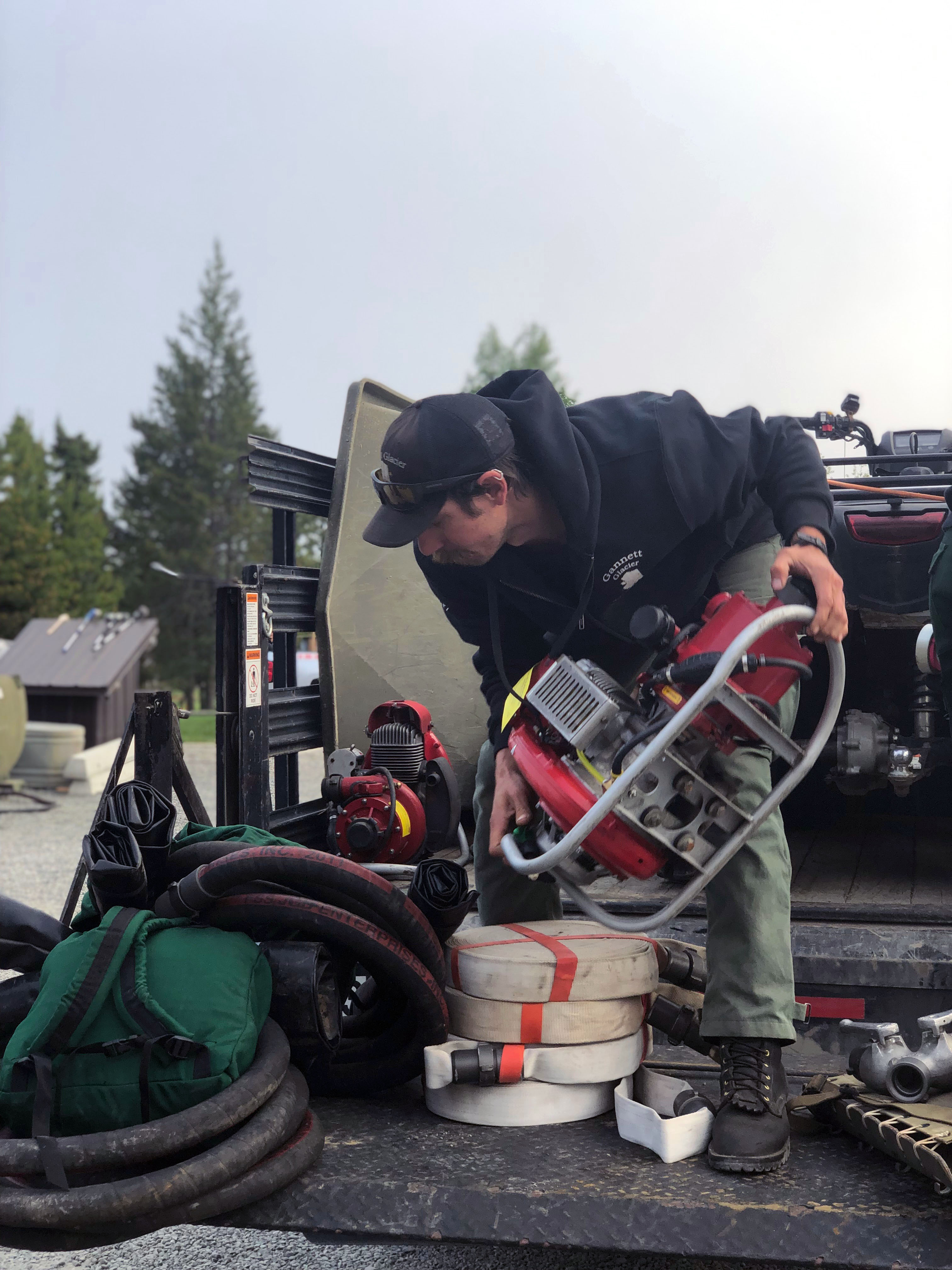
A member of the Gannett Glacier Type 2 Initial Attack Crew loads a water pump and fire hose into a truck to be transported to the Swan Lake Fire burning in the Kenai National Wildlife Refuge. Photo by Sarah Saarloos/Alaska Divsion of Forestry
Today, firefighters will focus efforts on constructing miles of hose lays in order to capitalize on a series of natural and man-made barriers, including the 2017 East Fork burn scar. They will also establish spike camps to reduce travel time during this period of heavy tourist traffic.
A Temporary Flight Restriction (TFR) is designed to protect fire personnel who are conducting aerial transportation and suppression efforts from the interference of private, commercial, drones or airplanes of any kind. All pilots and drone operators are required to comply with this FAA travel restriction.
WEATHER: Anticipate an increase in cloud cover with a chance of light rain in the afternoon.
SAFETY: Smoke from the fire is visible from the Sterling Highway between mileposts 65 and 75. Motorists are urged to yield to fire apparatus entering the highway from the Alaska Division of Forestry station located at milepost 92. For current road conditions visit http://511.alaska.gov. A virtual joint information center (VJIC) has been set up online at www.kpboem.com for public information. Agencies are posting updates on safety, smoke impacts and fire-related information.
 OBJECTIVE: The fire is burning in a limited protection area within the Kenai National Wildlife Refuge. Fire managers with the Alaska Division of Forestry are working collaboratively with refuge personnel to manage the fire. They aim to reduce future wildland fire hazards and enhance wildlife habitat by allowing for fire’s natural role: creating a diversity of vegetation types and tree age classes. The Type 3 incident management organization is managing the fire’s growth and is focused on the protection of the community of Sterling while also mitigating smoke and fire impacts to the Sterling Highway.
KENAI NATIONAL WILDLIFE REFUGE INFORMATION: Questions or requests should be directed to the Refuge by calling 907-262-7021 or visiting http://www.fws.gov/refuge/kenai/visit/contact_us.html. Contact the Refuge Visitor Center by calling 907-260-2820 or by clicking http://www.kenai.fws.gov.

A perimeter map of the 8,400-acre Swan Lake Fire (#181) as of Thursday evening, June 13, 2019. For a downloadable PDF version of the map, go to Swan Lake Fire PDF map June 14.
Categories: Active Wildland Fire, AK Fire Info
