Please SLOW DOWN and exercise extreme caution where fires are burning near the Dalton Highway. It is a HOLIDAY WEEKEND and with increased fire activity along the corridor we ask for your patience as we may be engaging in point protection on the side of the road. Be aware that road shoulders are narrow and that pulling off for any reason is risky at best.
Thunderstorms are expected in the area today and tomorrow. Red flag warnings are in effect. Gusty winds are to be expected in the vicinity of the storms. The chance of new starts and rapid fire spread is likely.
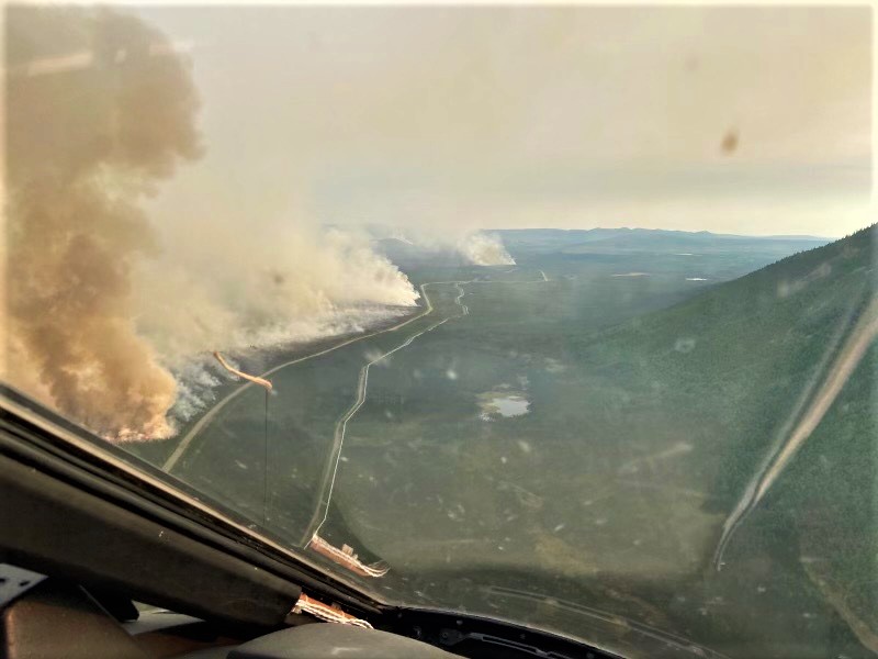
Overall, crews continue to monitor the Douglas Fire (336), and Curky Fire (318) with point protection on the Douglas and Curky fires wherever they approach the Alaska pipeline or other values. Yesterday afternoon, the Curky Fire 318 was mapped at 23,939 acres and the Douglas Fire 336 was mapped 14,950 acres. There is no change in size of the Fish Fire 319 (213 acres) or the Snowden Fire 330 (65 acres).
With continued firefighting activity in the area, the Arctic Circle Campground is closed until further notice, however the Arctic Circle Wayside Sign pullout is open.
Today is the second day of the Wildland Firefighter Week of Remembrance. Take a minute to appreciate the wildland firefighters as they protect lives, property, and resources.
Categories: AK Fire Info
