Managers prioritizing and assessing response as fire numbers increase due to lightning
BLM Alaska Fire Service is sending more resources to fires burning in Interior Alaska after a lightning event moved through the state Monday, triggering more than 30 fires in the BLM AFS protection area that covers the northern half of the state.
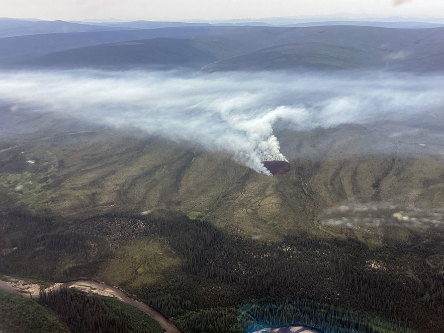
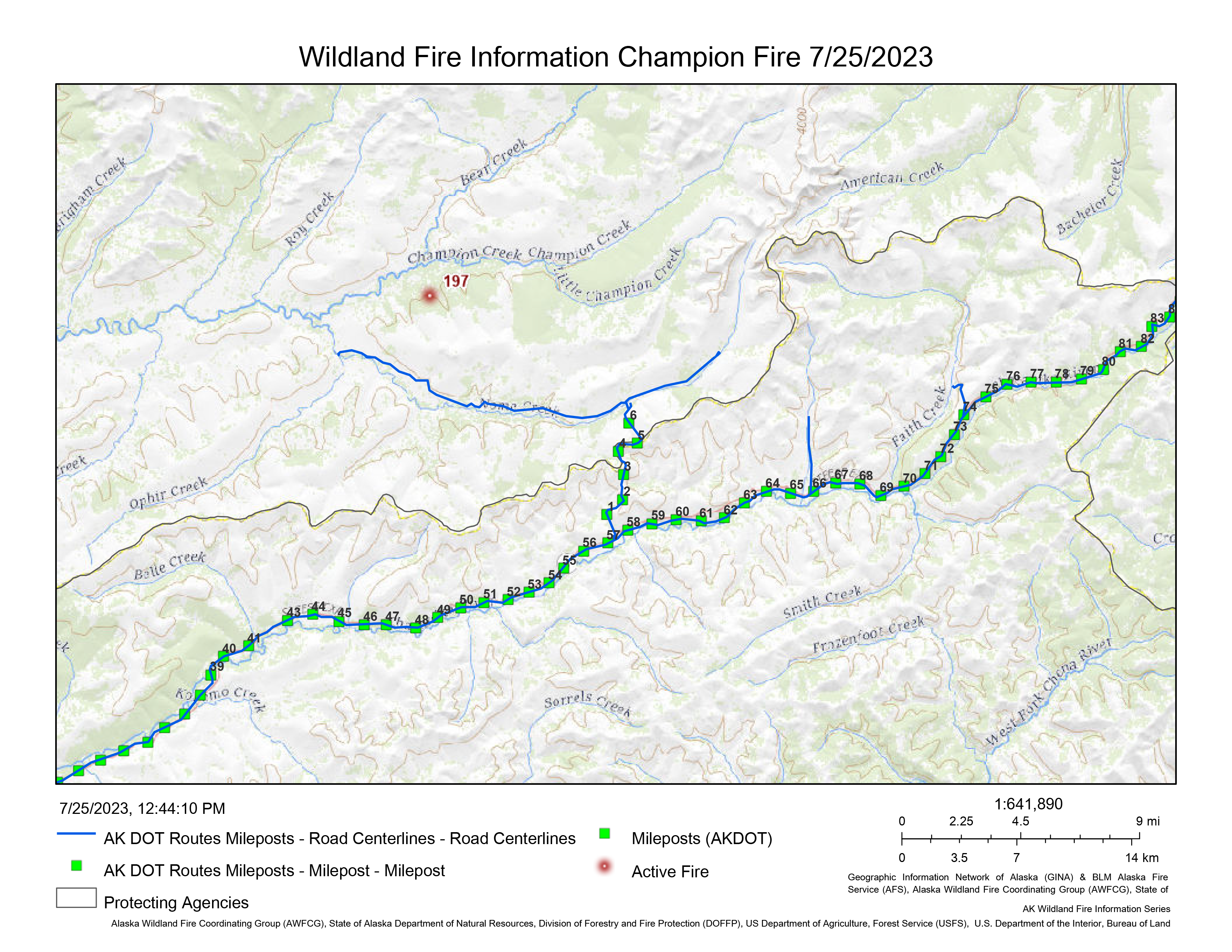
The BLM AFS Midnight Sun Hotshots, plus a few other firefighters, are headed for a fire burning on BLM-managed land on Table Mountain in the White Mountain National Recreational Area. The Champion Fire (#197) was burning in a limited management option area. This typically means it’s allowed to perform its natural ecological role undisturbed. However, because the Fortymile caribou federal subsistence hunt on federal lands begins on Aug. 1, BLM land managers and BLM AFS fire managers agreed to take action on the fire before it impacts the upcoming hunt. The fire was estimated at 30 acres as of 7:30 p.m. Monday, a few hours after it was reported by a pilot flying over the area.
The fire is burning in open tundra with some black spruce about 3 miles north of the Nome Creek West Road that turns left off of the U.S. Creek Road.
Hunters preparing for the hunt should be aware of fire activity, firefighters and equipment in the area.
Other crews are mobilizing for two other fires in Interior Alaska.
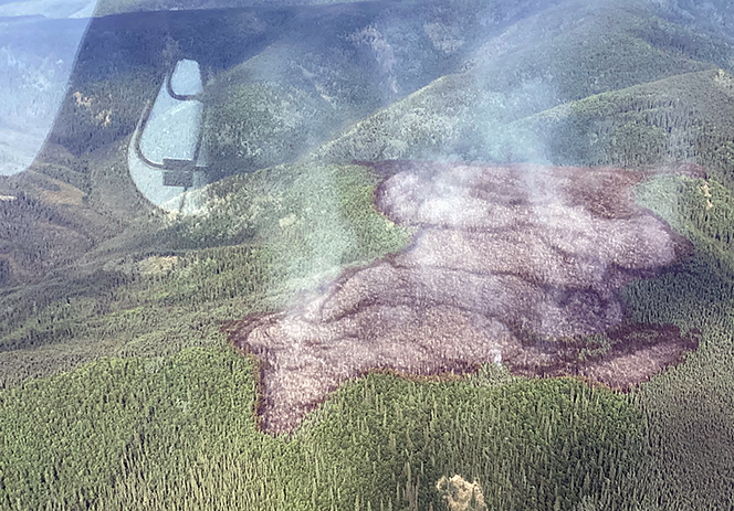
The Type 2 BLM-contract crew, the Mooseheart Crew, is assembling from Tanana and Minto to replace smokejumpers working on the Moose Fire (#200) burning off of the Elliott Highway near milepost 100. Smokejumpers were able to corral the 11.5-acre fire Monday night and are now focused on the time consuming and dirty job of mopping up hot spots. Further complicating this process is the lack of water near the fire and the large number of hot spots still present. A BLM AFS truck with a water tank and a firefighter are making the drive up from Fairbanks to help smokejumpers as the Mooseheart Crew also makes its way to the fire. Motorists will see firefighters and equipment in the area because the fire is about 50 yards off the north side of the highway, north of Minto.

The BLM AFS Type 2 training crew, the North Star Fire Crew, is diverting from working on a fuel break around Allakaket to work on the Klaluthyiit Bluff Fire (#219). The crew will take a boat 7 miles down the Koyukuk River and then down the Kanuti River to get to this fire. The fire was reported Tuesday morning and is estimated at more than 200 acres in size. It was detected via heat points recorded by satellite imagery. The fire is burning near Native allotments that the North Star Crew will work to protect.
Smokejumpers are wrapping up work on the Boulder Fire (#195) burning about a mile north of the Tanana Road west of Manley Hot Springs. The fire was stopped at about 2 acres in size, with smokejumpers working on extinguishing hot spots.
Elsewhere in BLM AFS’s protection area, fire managers are reassessing the priorities and response to the new fires that ignited as the result of about 18,000 lightning strikes across Alaska.
Part of that coordination includes the Alaska Division of Forestry & Fire Protection that also responded to new ignitions Monday evening. The lightning produced 41 new fires in the last 24 hours – 14 of them recorded today that are probably carried over from the night before.
While another day of higher-than-normal temperatures and lightning is forecasted today, the humidity levels and lack of wind will help firefighters working on the new fires that are so far burning mostly surface vegetation.
Meanwhile, BLM AFS fire managers will keep an eye on other fires including the 678-acre Morelock Fire burning in the 20 miles northwest of Tanana and the 448 Delta Fire (#221) burning in the Donnelly Training area east of the Delta Creek.
BLM AFS Fire Management Zones have scheduled numerous flights to gather information on fires that are spread out across the state, from the 218-acre Biederman Fire (#192) burning in the Yukon-Charley Rivers National Preserve about 50 miles west of the Canadian border to the Eli Fire (#216) in the Noatak National Preserve in the Northwest Arctic about 566 miles away.
With the added fires and burned area, Alaska has surpassed the lowest recorded number of acres burned in a season. As of 2 p.m., 204 fires have burned almost 5,000 acres, with 2,492 lightning strikes recorded so far.
For more information, contact BLM AFS Public Affairs Specialist Beth Ipsen at (907)356-5510 or eipsen@blm.gov.

Categories: Active Wildland Fire, AK Fire Info, BLM Alaska Fire Service
