Update 4 p.m., July 18, 2025. Thanks to moderated fire activity and successful suppression efforts on the Ptarmigan Complex, the Level 1 “Ready” evacuation notice was lifted for the Central Area.
While this is encouraging news, residents are urged to stay alert – fires are still active nearby, and Alaska remains in fire season.
Residents can take simple steps to reduce wildfire risk: move flammable items like firewood, ATVs, and gas cans at least 30 feet from homes; clear needles, leaves, and brush from roofs, decks, and yards; trim grass and low branches; and keep the first 5 feet around your home free of anything that could ignite. Cover attic vents with metal mesh to block embers, and ensure water sources like hoses or barrels are ready to use.
Find more information to make your property more Firewise here: https://ow.ly/56tL50Ws50p
12 p.m., July 18, 2025: The current Type 3 Incident Management Team (IMT) will be transitioning down to a Type 4 IMT on July 20. Daily fire updates on the Ptarmigan Complex will end on Saturday, July 19.
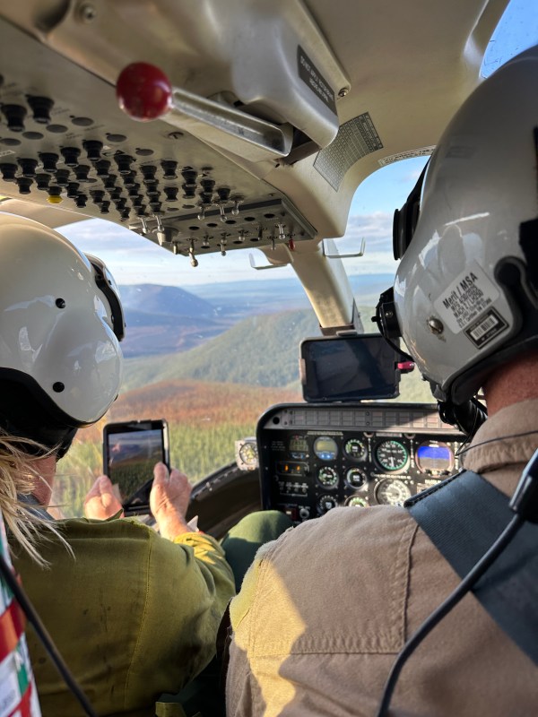
As crews complete work on the fires across the complex and the potential for fire spread decreases due to weather and observed fire activity, incident leadership have determined that fewer resources are needed and made the decision to transition to a less complex management strategy. A smaller group of firefighters will remain in the Central area to manage and work on the fires. Aviation resources will continue to operate in the Ptarmigan Complex airspace.
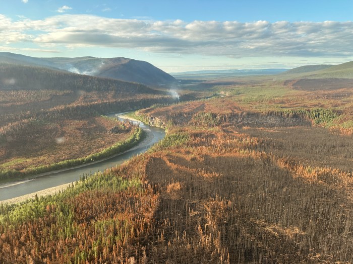
There has been very minimal fire activity across the Ptarmigan Complex over the past few days. Fire continues to creep, back, and smolder in places with occasional isolated tree torching observed on the Birch, Turtle, and Buckley Bar Fires A drying trend is forecasted for the weekend so an uptick in smoke may be observed, but the current longer term forecast calls for a southwest flow to potentially kick in by early next week which would bring wetter weather.

Turtle Fire (#243) – Fire behavior on the Turtle Fire was minimal, with creeping and smoldering observed. Crow Peak Wildland Fire Module and Alaska Range Suppression Module will continue to mop-up on the north end of the fire. They are working towards obtaining 100 feet of cold black along the edge. Pumps and hose will be backhauled from the east side of Birch Creek today, but pumps and hose will be left along the allotment lines. Two additional resources will be spiking out on the Turtle Fire to get a sense of the work remaining as operations transition to the Type 4 IMT.

The Turtle Fire was reported on June 19. It is burning about 10 miles east of Central, AK and 12 miles south of Circle, AK and was started by lightning.
Buckley Bar Fire (#264) – The fire remains in monitor status. The fire lies approximately 17 miles to the southwest of Central. It was discovered on June 20 and was caused by lightning.
Alligator Fire (#265) the Alligator Fire remains in monitor status. The fire was discovered on June 20, started by lightning and is located about 3 miles north of Central, AK.
Deadwood Fire (#214) – The fire remains in monitor status. The Deadwood Fire was started by lightning, discovered on June 20, and is in Central, AK.
Birch Fire (#256) – The fire remains in monitor status. The fire was discovered on June 20, caused by lightning, and is located about 4 miles northwest of Circle, AK.
A Level 1 “Ready” Alert remains in effect for the community of Central, the Steese Highway from Milepost 123 to Milepost 151, Circle Hot Springs Road and Circle Hot Springs, and Deadwood Creek Road. Drivers should expect traffic delays on the Steese Highway, Circle Hot Springs Road, and Deadwood Creek Road due to firefighting operations. A Level 1 “Ready” alert means: begin preparing for a potential evacuation; make plans for family members with special needs, pets, or livestock; gather essential items such as prescriptions, important documents, and valuables; and stay alert and watch for updates from local authorities.
NOTAM #: 07/118 is in place for the Central Airport (CEM): Increased air traffic 5,000 ft MSL and below within a 20 nautical mile radius of the Central Airport (CEM) due to firefighting aviation operations.
A PDF of the fire update can be accessed here.
–BLM–
Bureau of Land Management, Alaska Fire Service
P.O. Box 35005 1541 Gaffney Road, Fort Wainwright, AK 99703
Need public domain imagery to complement news coverage of the BLM Alaska Fire Service in Alaska? Visit our Flickr channel!
Learn more at http://www.blm.gov/AlaskaFireService, and on Facebook.
The Bureau of Land Management Alaska Fire Service (AFS) located at Fort Wainwright, Alaska, provides wildland fire suppression services for over 240 million acres of Department of the Interior and Native Corporation Lands in Alaska. In addition, AFS has other statewide responsibilities that include: interpretation of fire management policy; oversight of the BLM Alaska Aviation program; fuels management projects; and operating and maintaining advanced communication and computer systems such as the Alaska Lightning Detection System. AFS also maintains a National Incident Support Cache. The Alaska Fire Service provides wildland fire suppression services for America’s “Last Frontier” on an interagency basis with the State of Alaska Department of Natural Resources, USDA Forest Service, National Park Service, Bureau of Indian Affairs, U.S. Fish and Wildlife Service, and the U.S. Military in Alaska.
Categories: Active Wildland Fire, AK Fire Info, BLM Alaska Fire Service
