10:15 PM – The helicopter engaged in bucket work while Air Attack coordinated single-engine scoopers to reduce fire intensity and knock down active flames. By approximately 8:30 p.m., Air Attack reported that no open flames remained. The right flank continues to smolder, and a helitack crew remains on scene at the 15-acre fire. Firefighters observed that surface fuels were still holding heat, but fire spread into the underlying duff was limited.
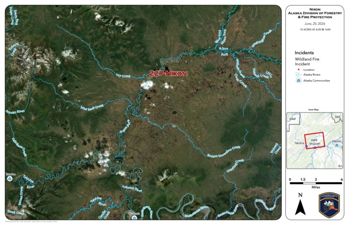
6:00 PM – Around 4:45 p.m. Saturday, heat signatures were detected via satellite approximately 15 miles north of McGrath. A Division of Forestry & Fire Protection (DFFP) helicopter responded to investigate and located the 5–10 acre Nixon Fire burning in spruce between the Nixon Fork River and Ivy Creek.
The helicopter is currently conducting bucket drops to slow the fire’s spread. A Type 2 hand crew and single-engine scoopers have been ordered to support suppression efforts. No structures are currently threatened.
Categories: Active Wildland Fire, Alaska DNR - Division of Forestry & Fire Protection (DFFP)

