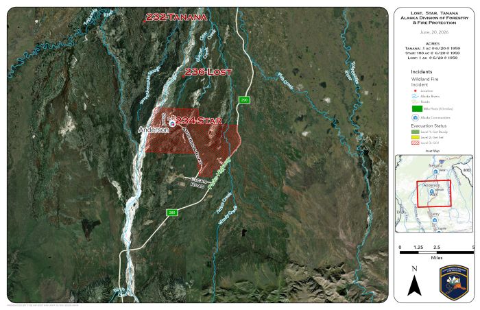
The Tanana Fire (#232) was reported just after 6 p.m. and is estimated at 1 acre. The fire is burning in black spruce and tundra approximately 6 miles west of Mile 295 of the Parks Highway near the 2023 Shores Landing Fire. Water scooping aircraft and Smokejumpers are responding.
The Lost Fire (#236) is estimated at 0.1 acre and is burning in spruce between Lost Slough and Clear Creek, approximately 2.5 miles north of Anderson. Aerial resources assigned to the Tanana Fire will also respond to the Lost Fire as available.
Suppression actions are underway. This will be the last update of the night for the Tanana Fire (#232) and the Lost Fire (#236)
Categories: Active Wildland Fire, Alaska DNR - Division of Forestry & Fire Protection (DFFP)
