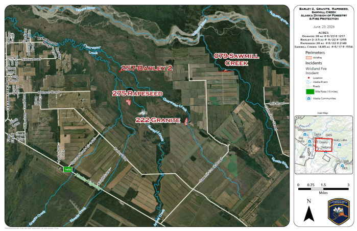
Rapeseed Fire (#275)
Initially reported on June 22, the Rapeseed Fire (#275) is located approximately 5.3 miles east of Milepost 1410 of the Alaska Highway. The fire is estimated at 39 acres and is burning primarily in black spruce.
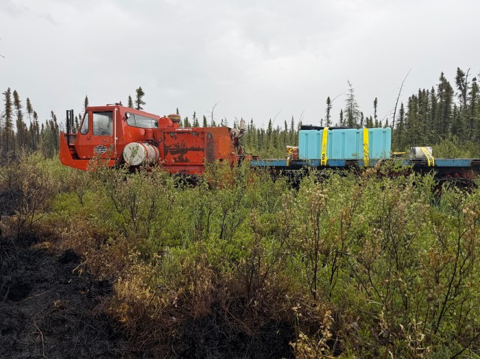
A soft tracked vehicle known as a Nodwell is being used on the incident due to its ability to operate in sensitive terrain with reduced ground disturbance. The fire is located near the headwaters of the Clearwater River, which supports spawning habitat for salmon and grayling.
The White Mountain Type 2 Initial Attack Crew is actively engaged on the fire, constructing fireline along the back edge of the incident. Fireline is created by removing vegetation and other flammable materials down to mineral soil to help slow or stop fire spread.
Rain was reported on the fire Tuesday morning, significantly moderating fire behavior.
Granite Fire (#222)
Reported on June 20 at approximately 2 p.m., the Granite Fire (#222) is estimated at 36 acres, burning in farmland and spruce. Resources assigned to the fire include a TCC squad, a thermal detection drone, and the Southwest Type 1 Crew. The fire is estimated to be 80% contained.
Moosehead Fire (#268)
Reported by a passing pilot on June 22, the Moosehead Fire (#268), located between Moosehead Lake and George Lake, was reached by riverboat on June 23 and estimated at 50 feet by 150 feet, smoldering in mixed spruce and hardwoods. Heavy precipitation was observed around 3 p.m., reducing fire activity. A firefighter was transported to the incident by boat, engaged in suppression activities, and declared the fire contained and controlled.
Barley 2 Fire (#257)
The Barley 2 Fire (#257) was reported on June 21 and is estimated at 3.5 acres, burning in spruce. Initial attack was conducted by helicopter using bucket drops. TCC Squad B remains assigned and engaged on the incident. Rain was reported in the area Tuesday afternoon. The fire is estimated to be 60% contained.
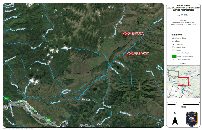
Shaw Fire (#226)
The Shaw Fire (#226) grew from an estimated 550 acres at 5 p.m. Monday to 2,483 acres by 9 p.m. Monday evening. Abundant rainfall was reported in the area Tuesday, moderating fire behavior. The fire is currently being monitored while firefighters evaluate weather conditions and fire activity.
Pogo Fire (#223)
Reported on June 20, the Pogo Fire (#223) is burning in a drainage approximately 2 miles north of Shaw Creek Road in hardwoods and spruce. The fire is estimated at 550.62 acres and is being monitored while firefighters evaluate weather conditions and fire activity.
Categories: Active Wildland Fire, Alaska DNR - Division of Forestry & Fire Protection (DFFP)
