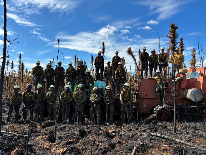
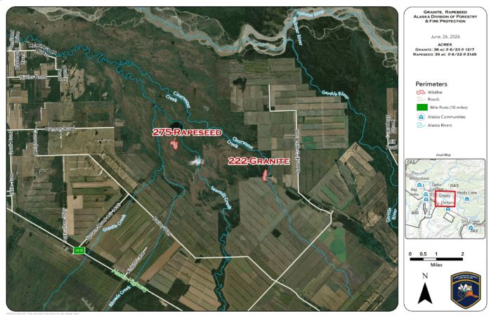
#222 Granite Fire- Located approximately 17 miles southeast of Delta Junction, the Granite Fire is currently 90% contained. The Southwest 1 Crew, TCC Crew, and Clackamas Crew continue suppression efforts on the 36 acre fire.
A thermal detection drone was flown over the incident to locate any remaining heat hidden beneath the tundra.
#275 Rapeseed Fire- Located approximately 13 miles east of Delta Junction, the Rapeseed Fire is 100% contained and mapped at 39.55 acres.
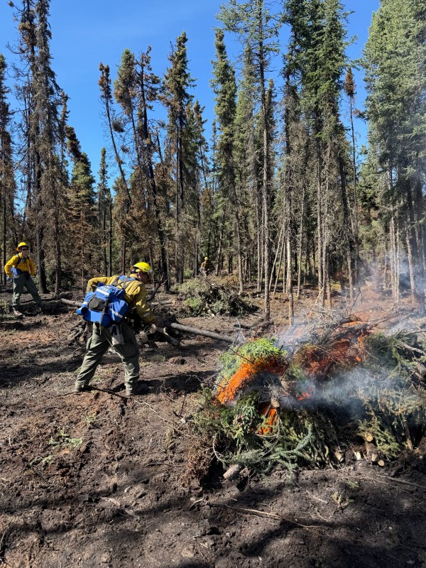
The White Mountain Type 2 Initial Attack Crew spent the day conducting mop up, extinguishing remaining hot spots, and removing hazard trees. They gridded a 300 foot perimeter outside the fire, searching for hot spots or spot fires, and found none. They continue working deeper into the fire’s interior to locate and extinguish any remaining heat. Due to the extremely wet, boggy terrain, a SUSV will be used to transport firefighters and their gear while minimizing impacts to the sensitive environment.
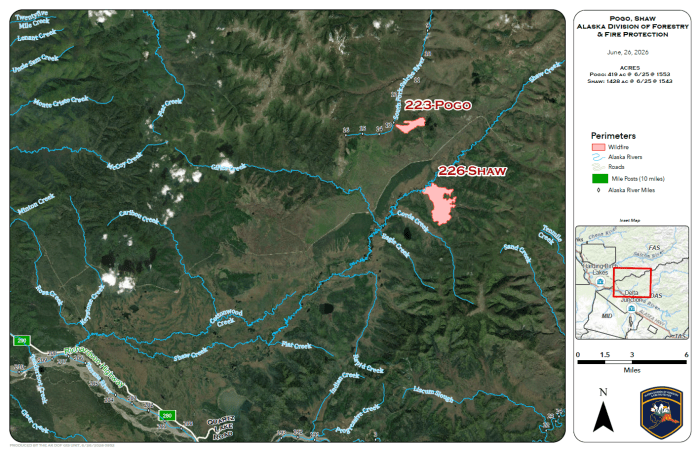
#226 Shaw Fire- Located south of Mile 27 on Pogo Mine Road, updated aerial mapping has revised the Shaw Fire to 1,428.22 acres. The fire remains in monitor status.
#223 Pogo Fire- Located approximately 2 miles north of Mile 27 on Pogo Mine Road, the Pogo Fire is estimated at 419.38 acres and remains in monitor status.
Categories: Active Wildland Fire, Alaska DNR - Division of Forestry & Fire Protection (DFFP)
