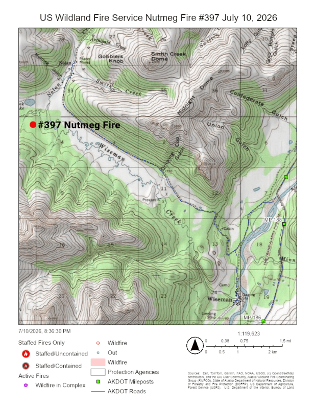
Fire managers are keeping a close eye on a wildfire burning 5.5 miles northwest of Wiseman near Wiseman Creek and Nolan Road. The lightning‑caused Nutmeg Fire (#397) was discovered on Thursday and is burning in an area designated as a Limited Management Option. Fires in these areas are monitored and allowed to perform their natural ecological role.
Because of its size and its proximity to the community of Wiseman, a large mining operation to the north, and its visibility from the Dalton Highway, fire managers are sending two smokejumpers to the area to maintain a close watch on fire behavior and report real‑time conditions. Their observations will help guide ongoing assessments and any actions to protect the community, the mine and cabins in the area.
When checked by a reconnaissance flight today, the fire was estimated at roughly 200 acres and has since grown to 1,000 acres and is burning in brush up to marshy areas south of Wiseman Creek.
For updated fire information, visit Alaska Wildland Fire Information (akfireinfo.com). Contact Public Affairs Specialist Beth Ipsen at Elizabeth_ipsen@ios.doi.gov or (907) 356-5510 for more information.
Download a PDF version of this fire update.
-USWFS-
U.S. Wildland Fire Service, P.O. Box 35005 1541 Gaffney Road, Fort Wainwright, Ak 99703
Need public domain imagery to complement news coverage of the USWFS in Alaska? Visit our Flickr channel!
Learn more online, and on Facebook.
Categories: AK Fire Info, US Wildland Fire Service

