
- Acres: 7,260
- Containment: 29%
- Location: Tok, AK
- Start Date: Aug. 17, 2026
- Fuels: Black Spruce, Shrubs, Grass
- Personnel: 328
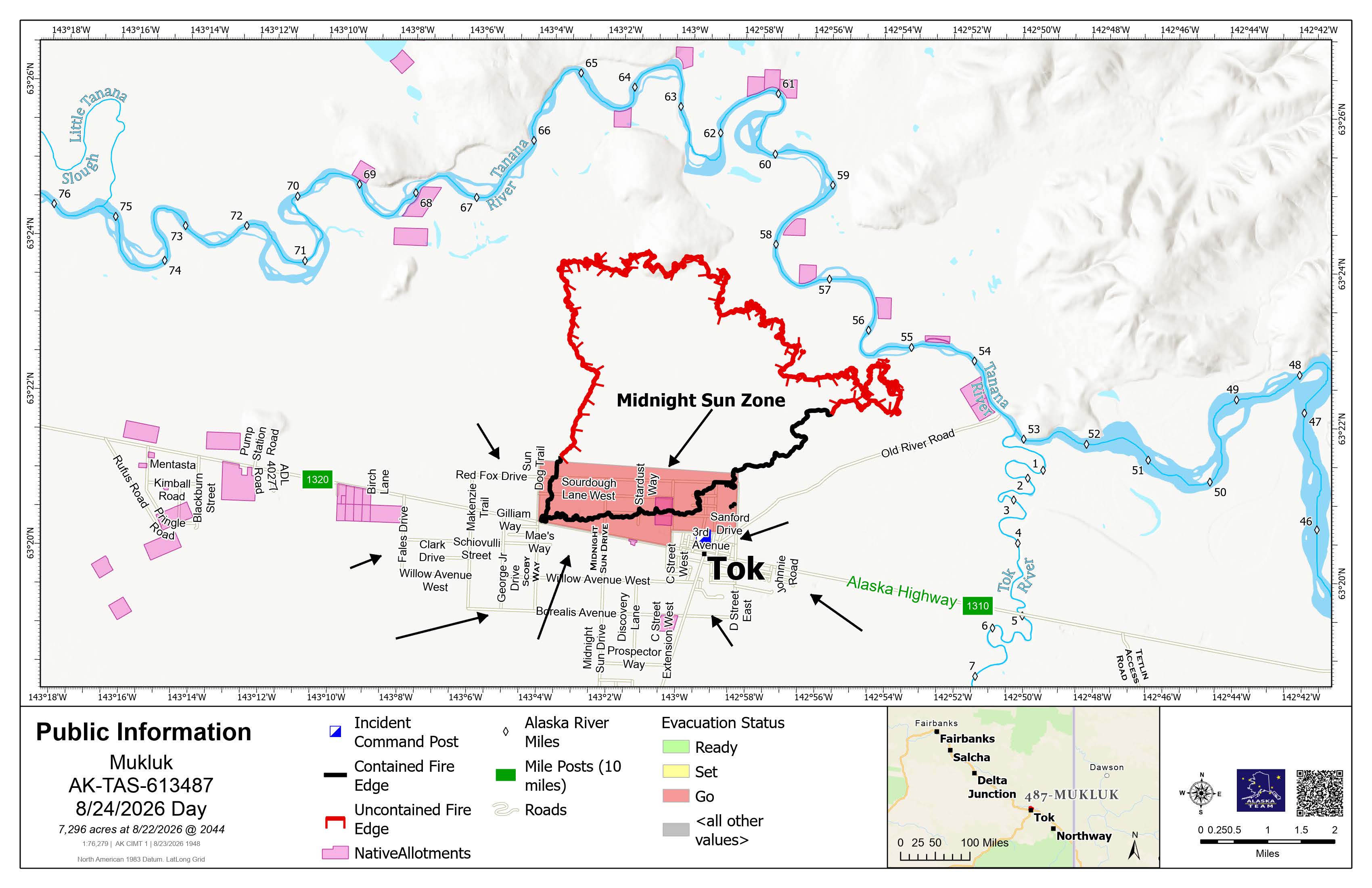
Highlights: Recent significant rainfall in the Mukluk Fire area allowed officials to lift all Level 1 READY and Level 2 SET evacuation zones on Sunday afternoon. Level 3 GO! Midnight Sun Zone on the north side of the Alaska Highway from Sun Dog Trail to 5th Street East and north of Red Fox Drive, remains in place. While the overall fire threat in this zone has decreased, hazard trees continue to pose serious safety risks for firefighters, emergency responders, and the public.
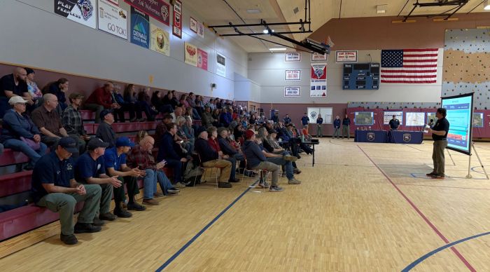
Around 100 people attended a community meeting at Tok School Sunday evening, where fire, emergency response, and assistance officials provided updates on the current fire situation, the outlook, and available recovery support for those affected by the Mukluk Fire. A recording of the meeting is available on the Alaska Division of Forestry & Fire Protection YouTube channel and Facebook page.
Operations: Firefighters took advantage of approximately half an inch of rain to make progress along the southern perimeter, which remains under evacuation. Crews are cooling hot spots, removing unstable trees, and clearing brush around homes and roadways. Work was briefly paused Sunday due to safety concerns brought on by wind and rain. Engine crews continue nighttime patrols in parts of Tok impacted by the fire to watch for any potential flare-ups.
The Alaska Team is coordinating closely with Alaska Power & Telephone to bring utility workers into cleared areas as soon as conditions are safe. This careful, step‑by‑step process will improve safety and help restore power before residents are allowed to return to the evacuated area.
Evacuations: Level 3 GO! (Red) for Midnight Sun Zone, the area on the north side of the Alaska Highway from Sun Dog Trail on the west to 5th Street East on the east to north of Red Fox Drive.
Weather & Fire Behavior: After Sunday’s substantial rainfall, warmer and drier conditions return Monday before colder, wetter weather moves in Tuesday. The added moisture to the ground and heavy vegetation will limit fire spread, with activity expected to be mostly creeping, smoldering, and occasional isolated torching within the established perimeter. The fall‑like weather in the coming days will support firefighters as they work toward containment along the perimeter and around affected structures.
Mukluk Fire Information:
- Information Line: (907) 505-0362 – Hours: 8 a.m. – 8 p.m.
- Email: 2026.Mukluk@firenet.gov
- For more information: https://linktr.ee/2026MuklukFire
Download a PDF version of this update.
Categories: Active Wildland Fire, Alaska DNR - Division of Forestry & Fire Protection (DFFP), public meeting

