Acres: 7,335
Containment: 29%
Location: Tok, Alaska
Start Date: Aug. 17, 2026
Fuels: Black Spruce, Shrubs, Grass
Personnel: 28
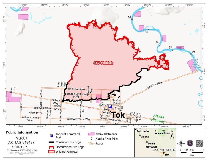
With hunting season underway, fire managers are urging hunters and others traveling near the western edge of the Mukluk Fire to stay out of the burned area north of Red Fox Drive. The western perimeter north of Red Fox Drive and the northern edge of the fire remain uncontained. Hotspots, fire weakened trees, ash pits and unstable ground continue to make this area unsafe.
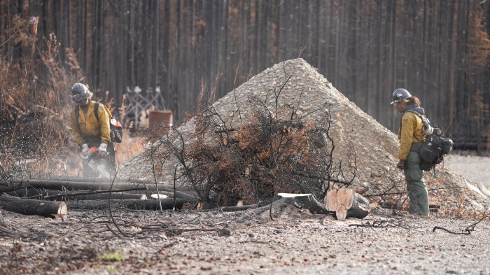
The Tanana Chiefs Conference Type 2 Initial Attack Crew continues working along the eastern perimeter, removing fire weakened trees near homes and private property. Although some trees may appear stable, the fire may have damaged or burned away their roots below the surface. One falling tree can strike others and create a domino effect, placing firefighters, residents and nearby property at risk. Removing these trees is especially important with gusty winds and rain forecast for the Tok area.
Management of the Mukluk Fire transferred to Tok Area firefighters at 8 a.m. Tuesday. The local Type 4 organization is led by Incident Commander Matt Durfey and Incident Commander Trainee Jenny Moser. Firefighters will continue suppression repair, patrol the fire perimeter and extinguish any remaining hotspots they find.
Weather & Fire Behavior: Rain showers moved through the Tok area Tuesday and is expected to continue Wednesday, becoming more scattered during the afternoon. Temperatures will reach around 52 degrees, with northwest winds around 15 mph and gusts up to 35 mph. A Wind Advisory remains in effect for the Upper Tanana Valley until 10 p.m. Wednesday. Rain may help cool remaining heat and dampen surface fuels. Hotspots may continue to produce visible smoke, particularly in portions of the fire that receive little precipitation. Fire behavior is expected to remain minimal, and the Mukluk Fire has remained within its current footprint since Aug. 27.
Fire season remains in effect in the Delta, Tok and Copper River protection areas through 11:59 p.m. Monday, September 14. Burn permits are still required, even with rain in the forecast, and anyone planning to burn must confirm that burning is allowed before beginning. Check online at https://forestry.alaska.gov/burn/
Mukluk Fire Information
Information Line: (907) 505-0362 – Hours: 8 a.m. – 8 p.m.
Email: 2026.Mukluk@firenet.gov
Categories: AK Fire Info

