Gusty winds shifting to the northwest Sunday will challenge firefighting efforts and overall safety on the Mukluk Fire.
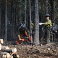
Gusty winds shifting to the northwest Sunday will challenge firefighting efforts and overall safety on the Mukluk Fire.
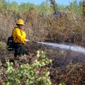
Firefighters, including crews from across Alaska and Yukon, Canada, took advantage of a second day of cooler, wetter weather to increase containment and continue aggressively mopping up around structures within the fire’s perimeter.

Acres: 7,426 Containment: 12% Location: Tok, AK Start Date: Aug. 17, 2026 Fuels: Black Spruce, Shrubs, Grass Personnel: 219 Highlights: On Thursday, an Uncrewed Aircraft System (UAS) module used an infrared-equipped drone to obtain more accurate mapping of the fire. This improved mapping captured fire growth that occurred over the past two… Read More ›

Highlights: As of 7:00 am Thursday, the Alaska Complex Incident Management Team #1 has taken over command of the Mukluk Fire. On Wednesday, two water-scooping aircraft arrived from Canada, along with the Midnight Sun Hotshot Crew and Tanana Chiefs Type… Read More ›

The Level 3 GO! evacuation zone has been reduced in size from how it appeared Monday and Tuesday. Residents have been asked to avoid entering the evacuation area. Returning residents can block access and delay firefighters. Additionally, active fire, hazardous materials,… Read More ›
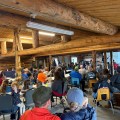
The Mukluk Fire (#487) is 16% contained. The secured portion is in the community of Tok. Satellite mapping estimates the fire at 5,077 acres, though heavy smoke and clouds obscured portions of the north and northeastern edge. Acreage is expected… Read More ›

UPDATE 10:30PM: The Mukluk Fire (#487) is now 16% contained, with the secured portion located in the community of Tok. Satellite mapping estimates the fire at 5,077 acres, however heavy smoke and clouds covered portions of the north and northeastern edge of the fire, so the acreage is expected… Read More ›

