Forecasted rain and cooler temperatures today are expected to moderate fire activity and smoke across the region, though a Red Flag Warning remains in effect for Yukon Flats due to lightning activity. Air quality advisories are in effect for central and eastern Alaska. If you or your family have questions on smoke impacts to health or need additional resources, visit the Alaska Department of Environmental Conservations page on Wildfire Smoke, Health & Safety. There are currently 152 active fires: 53 in critical or full protection and 99 in limited management zones. 243,918 acres have burned statewide.

HIGHLIGHTED FIRE ACTIVITY
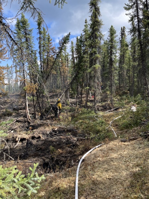
Lost Horse Creek (#296) – [8,281 acres] North of Old Murphy Dome Road, 3.5 miles east of Mile 18 Elliot Highway. Dozers and hand crews continue work to control and contain the fire along the southern perimeter to structures in the Haystack subdivision. Additional indirect line is being constructed to protect values at risk and further work is being done to improve structure protection measures. Fairbanks North Star Borough changed the evacuation status from Level 3 (GO) to Level 2 (SET) for the Upper Haystack subdivision. (222 Personnel)
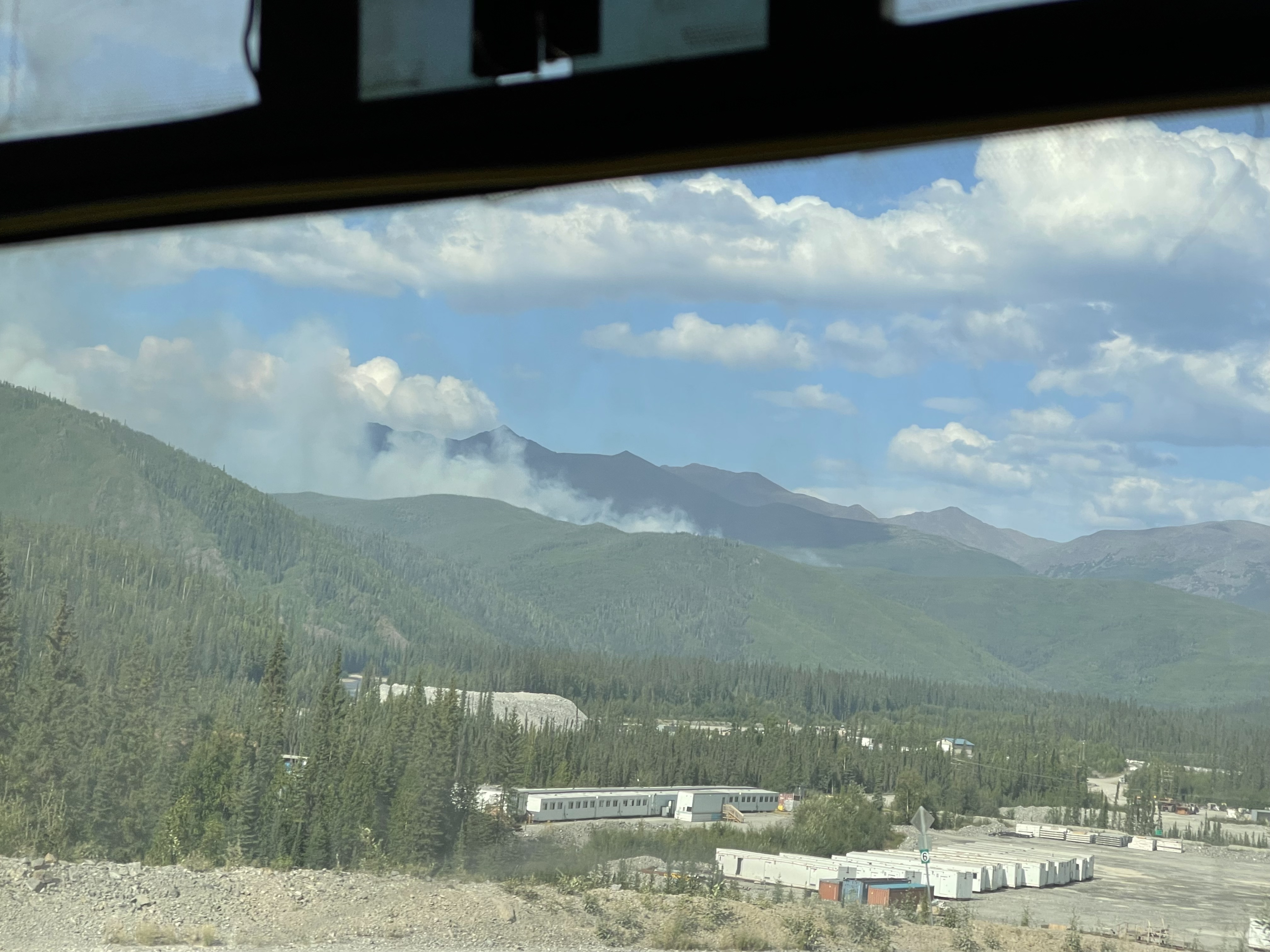
Anderson Complex (#899) – [50,696 acres] Anderson-Clear area. Rainfall moderated fire behavior on the northern half of the fire area yesterday, slowing fire spread on the Teklanika River and Shores Landing Fires. Resources continue to assess values at risk and implement structure and point protection and defensive actions as necessary. Evacuation levels remain in place from the Denali Borough. (271 personnel)
McCoy Creek (#201) – [9,500 acres] River mile 29, Salcha River. Firefighters continued mopping up the fire behind the properties along the Teklanika River and prepping structures on the north side of the fire. Evacuation levels remain in place from the Fairbanks North Star Borough. (136 personnel)
Pogo Mine Road (#191) – [40,400 acres] 9 miles down Pogo Road. Fire activity continues to be active, and resources are working on containment line and hot spots. Limited visibility from smoke was a challenge yesterday for utilizing aviation resources. (30 personnel)
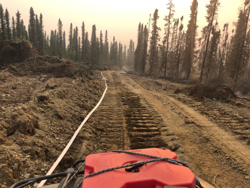
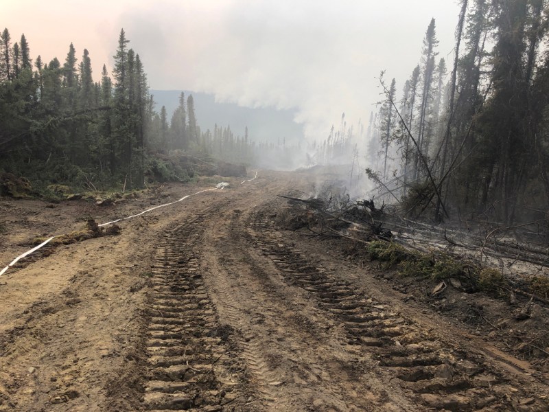
Sand Lake (#261) – [123 acres] 6 miles northwest of Dot Lake. There was no new growth on the northwest end of the fire and minimal on the northeast end. Crews focused on establishing saw line and hose lays reaching the upper left flank towards the saddle and are mopping up on the west flank. (61 personnel)
Mosquito Creek (#290) – [35 acres] 5 miles east of Harding Lake. There was minimal activity on the fire yesterday. Resources were able to burn excess fuel in the interior of the fire and continue to improve containment lines. (43 personnel)
Mount Hayes (#299) – [7,000 acres] 24 miles southeast of Delta Junction. Ground personnel put in 3000` of hose lay with sprinklers on the dozer line made from Bison Fields to the river to the east. Air tankers delivered a few retardant drops until their visibility from smoke was impacted. (10 personnel)
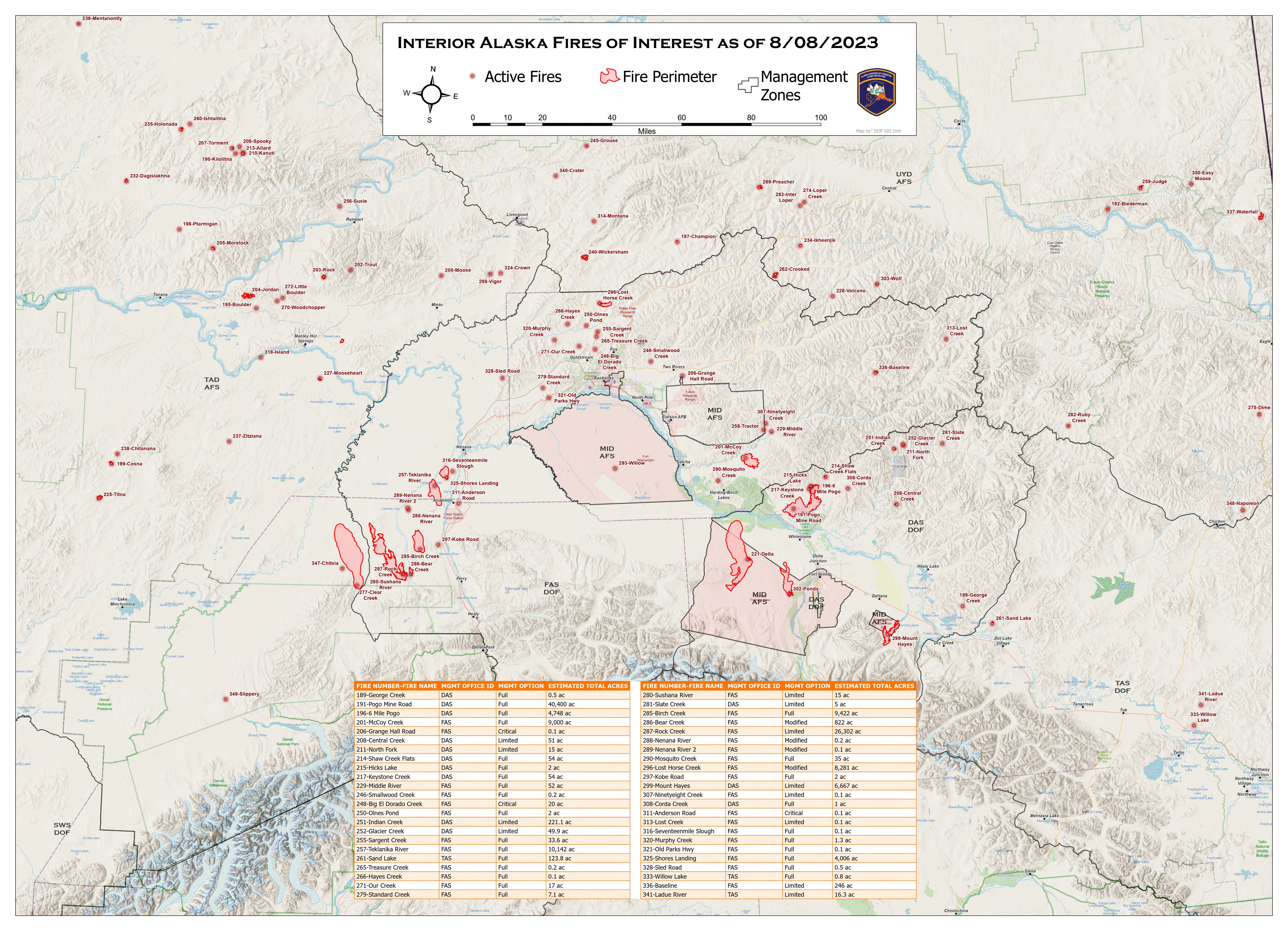
Map of fire activity in the Alaskan Interior as of August 8. For a downloadable pdf of the map, click here. 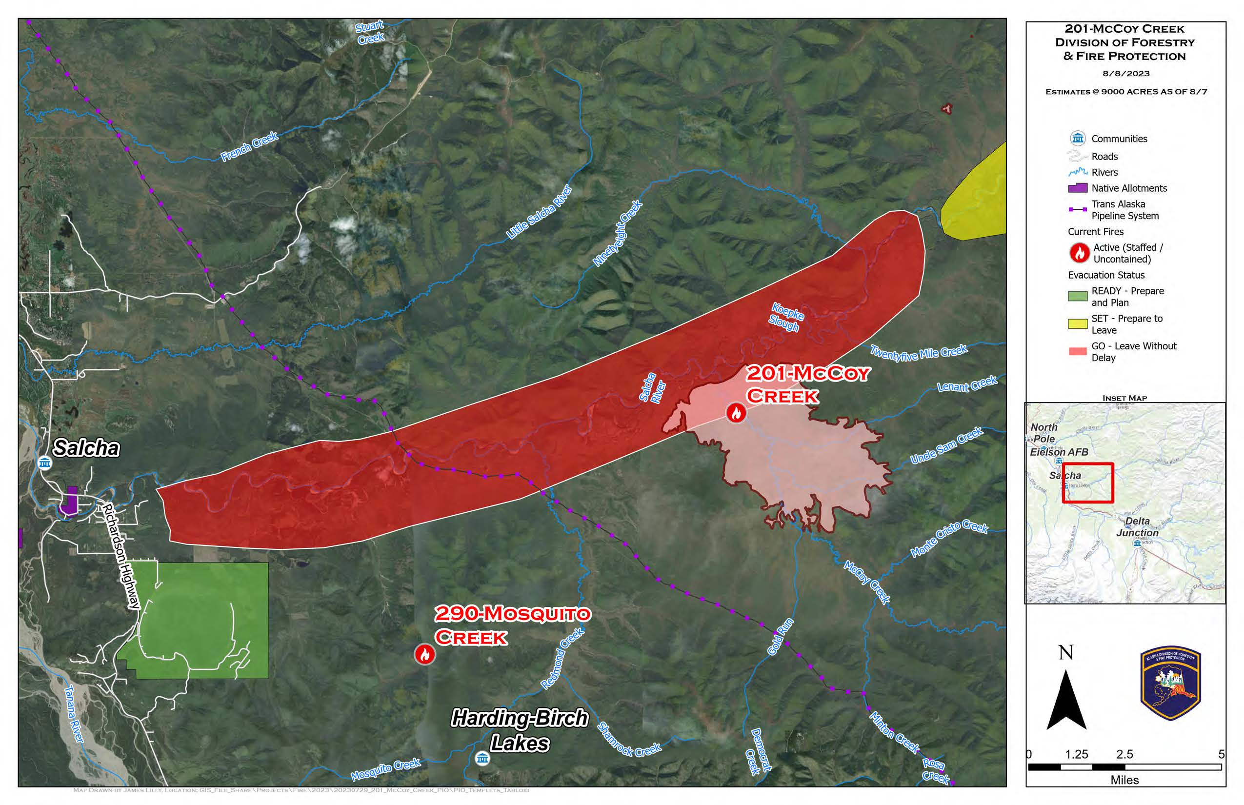
Map of McCoy Creek (#201) and Mosquito Creek (#290) Fires as of August 8. For a downloadable pdf of the map, click here. 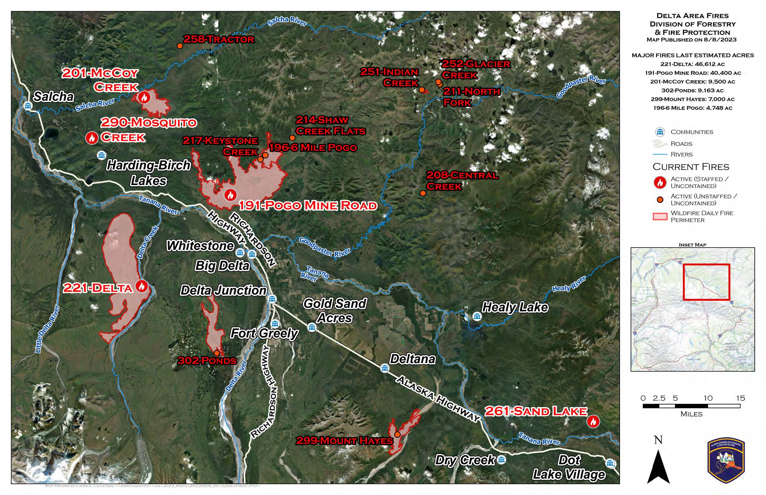
Staffed and unstaffed fires in the Delta Area as of August 8. The map also includes the nearby McCoy Creek (#201), Mosquito Creek (#290), and the Sand Lake (#261) Fires.
Categories: Active Wildland Fire, AK Fire Info
