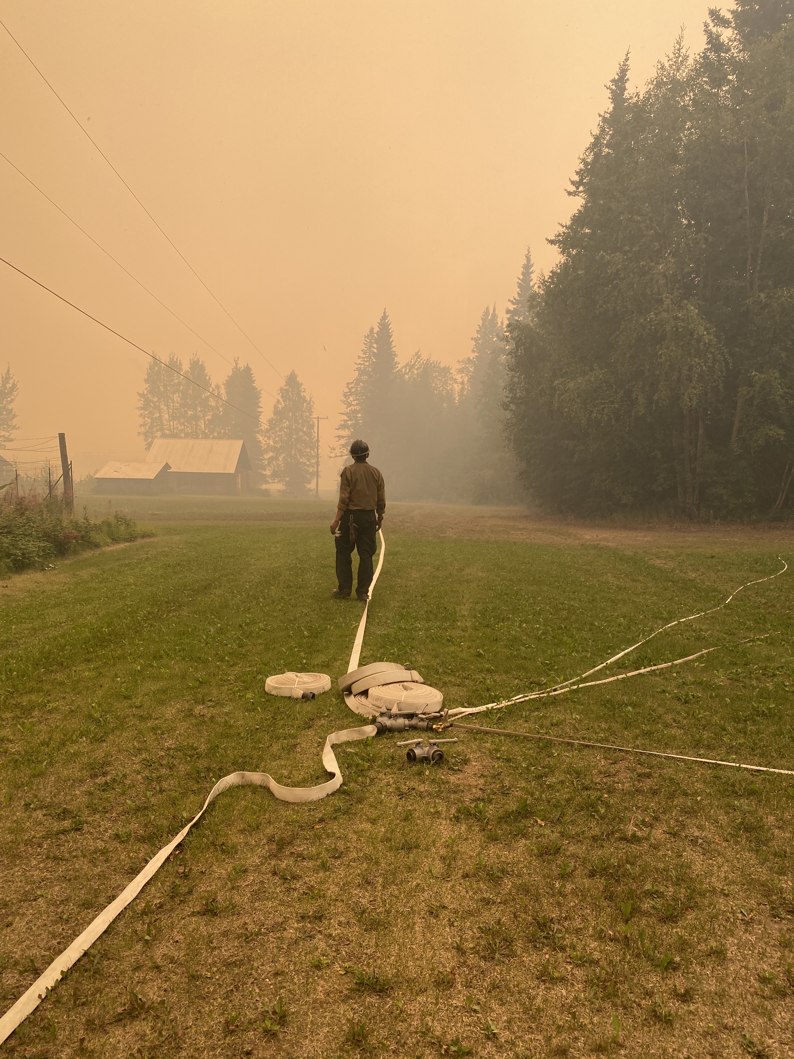
Thick smoke blanketed the Delta Junction area Monday, creating hazardous air quality and significantly limiting visibility, while also decreasing fire behavior. Firefighters focused primarily on structure protection especially on the Pogo Mine Road Fire (#191). Some of this work can be seen in the following video.
With unhealthy to hazardous air quality in the Delta Junction area, residents and visitors are encouraged to take the necessary safety precautions to protect oneself from the harmful impacts and increased driving danger. For more information please visit the following Alaska DEC Division of Air Quality website and also the fire and smoke map.
And now for more detailed fire updates from the Delta Junction area.
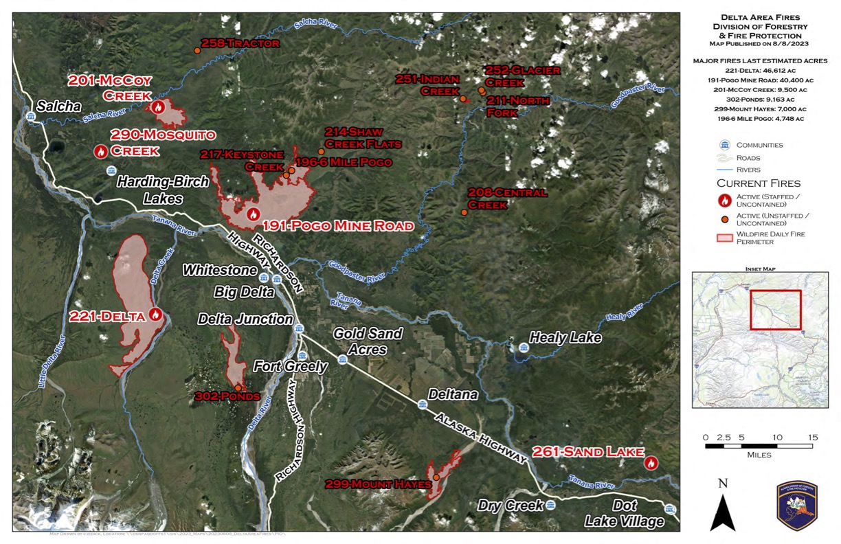
Pogo Mine Road Fire (#191) – [40,400 acres] 16 miles NW of Delta Junction. (30 personnel)
Firefighters are engaged in structure protection around private land along the Pogo Mine Road and in the Shaw Creek area. There several primary structures along pipeline road and near the Pogo Mine entrance gate. There’s also a focus on ensuring cabins that the fire burned around are protected. A group of firefighters were inserted by helicopter into remote cabins within the burn perimeter and along Shaw Creek.
While the majority of fire growth continues to the north, away from values at risk including structures and power lines, the fire also backed to the pipeline corridor. Fire #199 is located approximately 16 miles northwest of Delta Junction and is on the north side of the Richardson Highway. Management objectives are to keep Pogo Mine open and power lines protected, while keeping the fire north of shaw creek along the southern edge.
Mount Hayes Fire (#299) – [7,000 acres] 8 miles south of Deltana. (10 Personnel)
Fire picked up in activity Monday. Due to low visibility, aircraft could only make a few drops before returning to Fairbanks and Palmer. In an effort to stop this wildfire from moving to the northeast toward, heavy equipment operators built a dozer line from the Buffalo Fields to Gerstle Road to the Gerstle River. After completing the line, firefighters installed a 3000-foot hoselay with portable tanks, pumps and hoses in anticipation of the fire progressing to the north.
The fire is burning on military and state lands in the Gerstle River Arctic Test Site area. The fire jumped the Gerstle River to east. Aircraft has been dropping water on the spot east of the river to try to keep this fire in check. Management objectives are to keep the fire South of Gerstle Field System and Bison Trail, east of Sawmill Creek, and west of the Gerstle River.
Delta Fire (#221) – [46,612 acres] 20 miles west of Delta Junction. (8 Personnel)
The primary objective is to keep the fire within Delta Creek, the Little Delta and the Tanana rivers. Eight 8 smokejumpers were inserted Monday to protect cabins in the area. Fire managers are reviewing options to keep the fire south of the Tanana River.
Indian Creek Fire (#251) – [115 acres] Pogo Mine area. (unstaffed)
This fire is located near Pogo Mine and is currently in monitor status due to limited activity. If the need arises, aircraft will be sent to drop water to keep the fire in check.
Ponds Fire (#302) – [9,162 acres] 12 miles SW of Delta Jct. (unstaffed)
This 839-acre wildfire is currently south of the Richardson Highway in military land and is currently being monitored.
Categories: Active Wildland Fire, Air Quality, AK Fire Info
