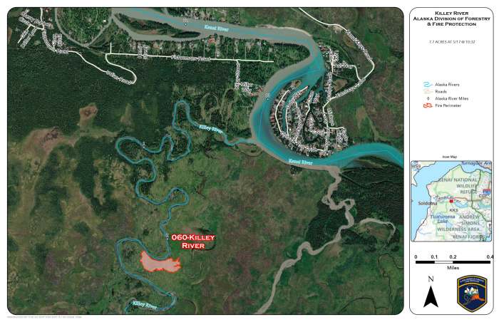
Fire investigators have determined that an escaped campfire is the cause of the Killey River Fire (060) burning along the river about 5-miles southeast of Funny River. Geospatial Imaging System Specialists have recalculated the fire’s perimeter to determine the size is 7.7-acres.
The Alaska Division of Forestry & Fire Protection (DFFP) Gannet Glacier Type 2 Initial attack Crew has completed their saw line around the fire perimeter. They are continuing to remove hazardous trees, snags, to safely conduct a grid search of the burned area for remaining areas of heat. The snags and jackstraw, downed trees are because the fire is within the 2014 Funny River Fire perimeter. With the investigation complete they are also mopping up the remaining hot spots at the fire’s point of origin.
Categories: Active Wildland Fire
