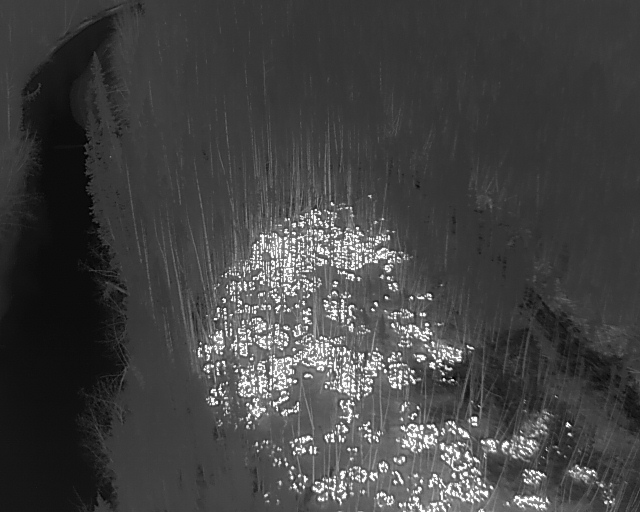
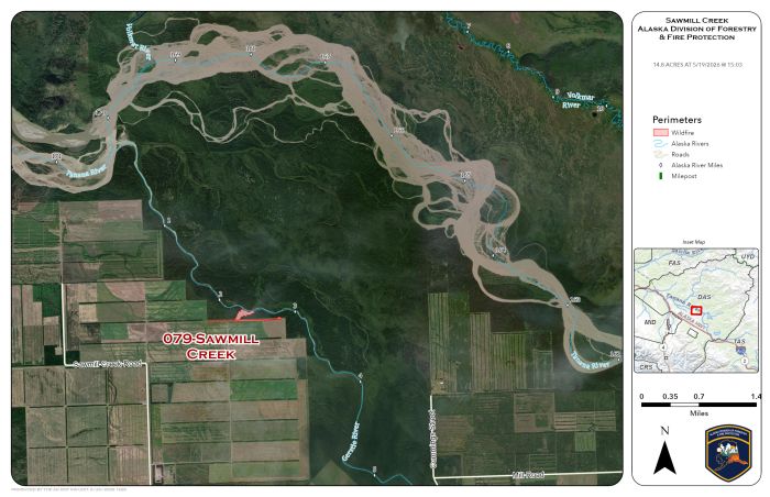
Alaska Division of Forestry & Fire Protection (DFFP) crews continue to improve their lines Wednesday around the Sawmill Creek Fire (#079) on the northern end of the Delta Agricultural Project near the end of Sawmill Creek Road, east of Delta Junction. DFFP Unmanned Aerial Systems (UAS) are assisting firefighters on the ground by utilizing their infrared camera to identify hot spots on the fire. The fire is designated to be a 100% Full Suppression fire. That means there will be no areas of heat or visible smoke across the entire fire before it will be called out.
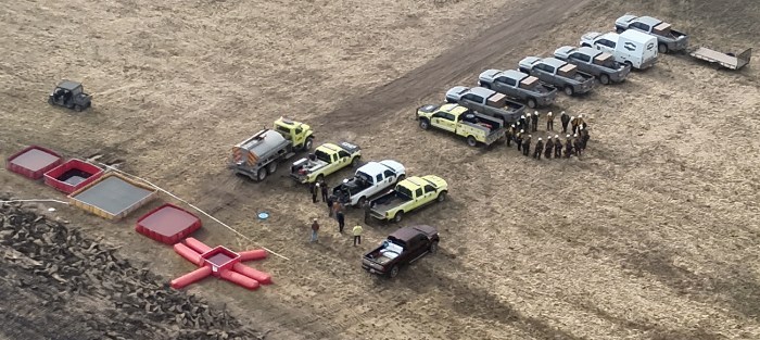
DFFP White Mountain T2IA crew and cooperating agency crew, Tanana Chiefs Small Module, are working along opposite flanks of the fire, starting from the fire’s edge and extinguishing all areas of heat into the black, burned area. Firefighters are working cautiously as fire weakened trees can topple unexpectedly and can be blown down easily by winds. The crews are assisted by two water tenders provided by local Delta fire departments and two local dozers with operators.
Passing storm cells with erratic winds on Monday, the day the fire started, scattered embers into the forested area around the fire and across the Gerstle River. UAS operations have identified numerous spot fires, each of which will be completely extinguished.
There are 44 personnel assigned to the fire. It is expected to take multiple days to complete the work needed.
Categories: Active Wildland Fire, Alaska DNR - Division of Forestry & Fire Protection (DFFP), UAS/Drones
