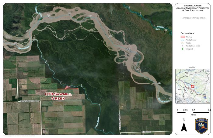
Alaska Division of Forestry & Fire Protection (DFFP) White Mountain T2IA Crew and cooperating agency, Tanana Chiefs Crew, extinguished all of the spots showing heat across the Gerstle River from the Sawmill Creek Fire (#079) on Wednesday. DFFP Unmanned Aerial Systems Module (UAS MOD) was able to guide the ground forces to each location using their infrared camera. The UAS MOD flew again Thursday to ensure there were no more heat indications across the river or in the green outside the burned area fire. Finding none, the module was released from the fire.
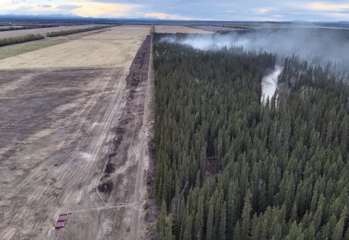
The crews will focus on the main portion of the fire in the forested area outside the agriculture field Thursday. TCC and White Mountain crews have mopped up 10 feet into the black on both sides of the fire from the ag field to the river. They will continue Thursday extinguishing all areas of heat and breaking up piles of downed trees to ensure there is no chance of the fire rekindling. The fire is designated to be a 100% Full Suppression fire. That means there will be no areas of heat or visible smoke across the entire burned area before the crews leave.
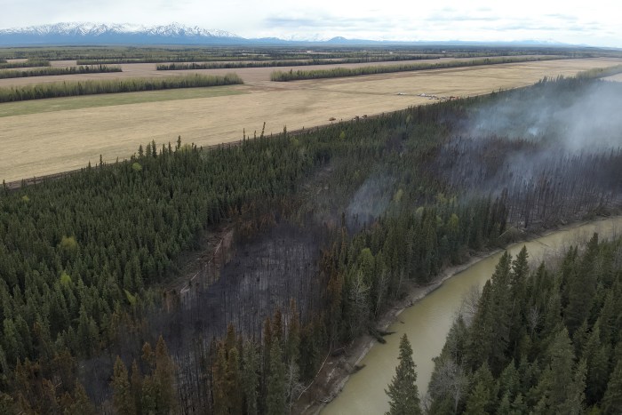
The portion of the fire furthest to the east that also burned into the forest has been declared contained and controlled. There were no areas of heat detected by the drone, but crews will continue to monitor the area for visible smoke and areas of heat. Firefighters and heavy equipment have extinguished the burned area stretching east to west along the north side of the agricultural field.
Minimal fire activity was observed Wednesday with precipitation and higher humidity in the fire area despite strong southerly winds. Gusty winds will continue Thursday and into Friday but are not expected to reach the criteria for a Red Flag Warning. A chance of scattered precipitation through Sunday is in the forecast. Fire danger remains high due to the widespread availability of dry fuels and winds.
Categories: Active Wildland Fire, Alaska DNR - Division of Forestry & Fire Protection (DFFP), UAS/Drones
