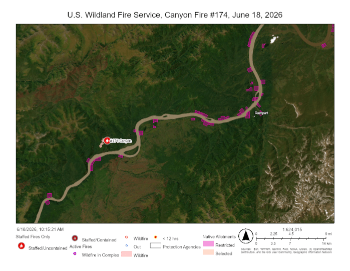
Light precipitation slowed the spread of the Canyon Fire (#174), enabling firefighters to continue cutting control line to protect two allotments and a cabin north of the Yukon River. The U.S. Wildland Fire Service Chena Hotshots are working on a Native allotment on the north side of the Yukon River, approximately 1.5 mile south of the fire and smokejumpers are working on another allotment and a cabin approximately 3 miles to the northeast of the fire, also on the north side of the Yukon River. The fire is estimated at 409 acres, smoldering in black and white spruce. Rampart is the nearest community, which is approximately 20 miles east of the fire and south of the Yukon River.
The fire was ignited by lightning on June 11, 2026. Because it is burning in a Limited Management Option Area, it is generally allowed to play its natural ecological role unless it threatens identified sites of value. However, Native allotments receive full protection status. Fire managers determined conditions warranted sending firefighters to the area earlier this week. Since the fire is still within the Limited Option area, they will focus on protecting the allotments without directly engaging the main fire.
Smoke is visible to both boaters and aviators traveling the Yukon River corridor.
Contact Public Affairs Specialist Beth Ipsen at Elizabeth_ipsen@ios.doi.gov or (907)356-5510 for more information.
-USWFS-
U.S. Wildland Fire Service, P.O. Box 35005 1541 Gaffney Road, Fort Wainwright, AK 99703
Need public domain imagery to complement news coverage of the USWFS in Alaska? Visit our Flickr channel!
Learn more online, and on Facebook and Twitter.
Categories: Active Wildland Fire, AK Fire Info, US Wildland Fire Service
